The Mongol Empire Map
The Mongol Empire Map
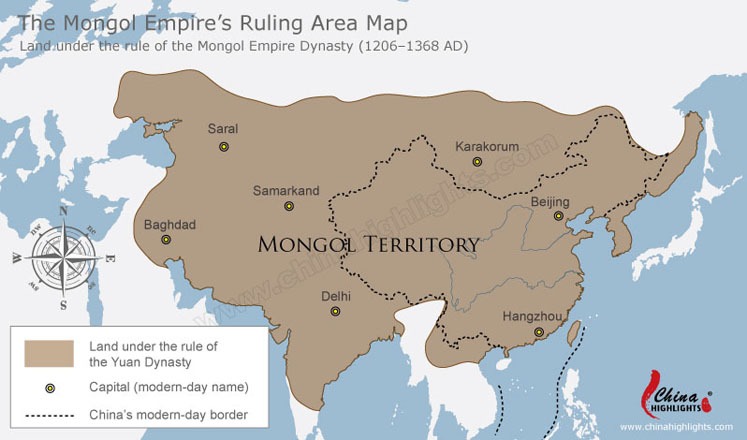
This map shows the land of the Mongolian Empire (1271 – 1368) and the modern-day borders of China and Mongolia. This was the highest point of China’s land area. The capital city was Beijing during this period.

Leave a Reply
You must be logged in to post a comment.